
Meteograma Snow
Você pode encontrar o Meteograma Snow no nosso website.
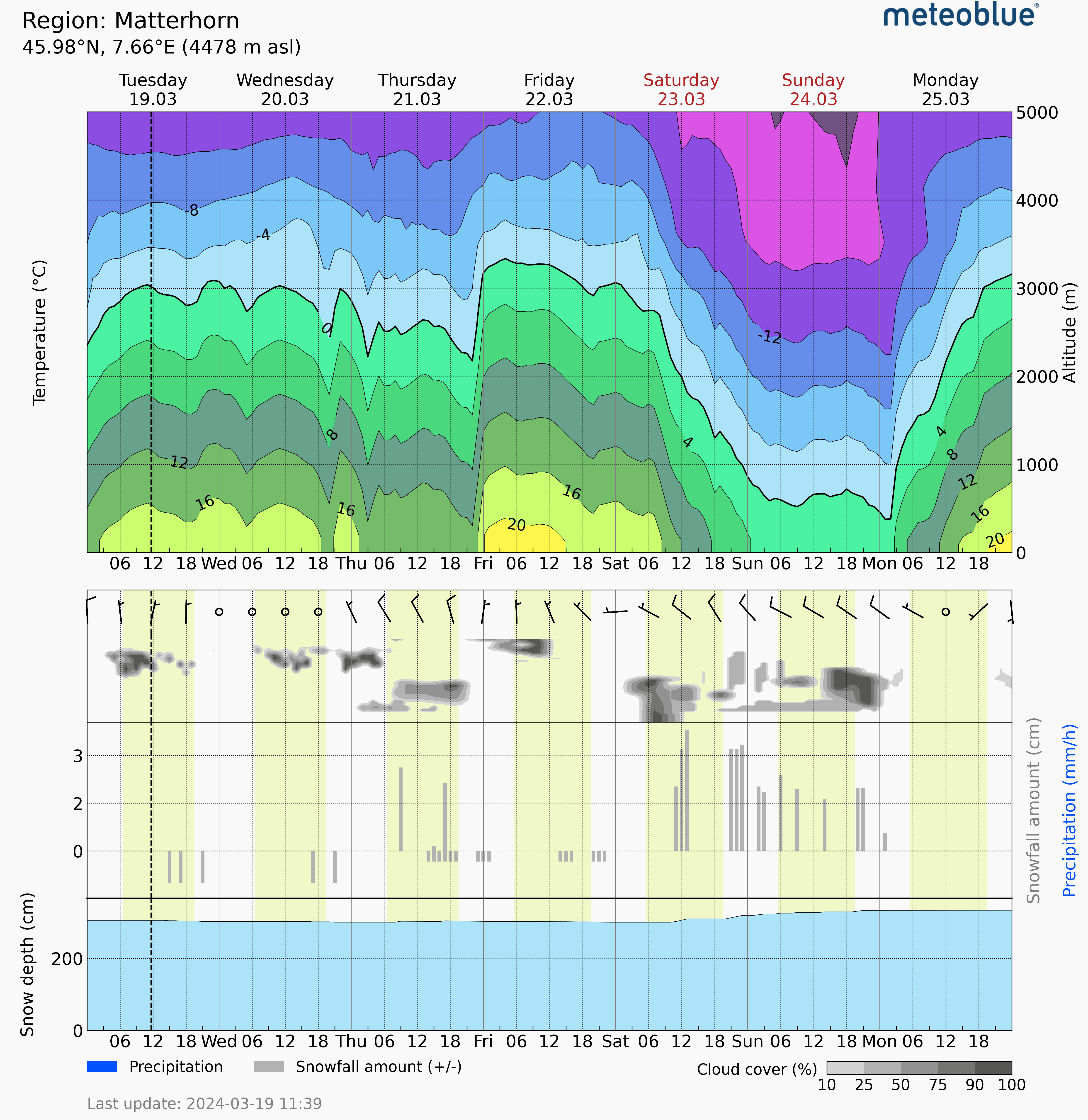
O Meteograma Snow é um diagrama que visualiza as condições da neve em uma área específica. Oferecendo uma previsão detalhada de 7 dias, ele exibe vários aspectos da neve, inclusive a temperatura horária em várias altitudes (destacando o nível de congelamento com a curva preta em negrito), a quantidade e o tipo de precipitação (azul para chuva e cinza para neve) para cada hora, a quantidade de neve derretida ao longo do tempo e a profundidade média da neve no solo para a área circundante. Essas informações permitem planejar atividades e prever o acúmulo ou derretimento de neve durante a estação.
O Meteograma Snow representa uma área (célula de grelha), em vez de um local específico. A elevação exibida reflete a elevação média dessa célula de grelha, que pode ser ligeiramente diferente de um local específico. Além disso, o eixo do tempo usa o horário local, válido quando a previsão é gerada.
Enquanto o Meteograma Snow fornece uma visão geral valiosa da área, mas as condições reais da neve podem variar significativamente dentro de distâncias curtas. Essa previsão não deve substituir as medições no local nem ser usada para avaliação de riscos críticos.
O Meteograma Snow é adequado para o planejamento de atividades de curto prazo em áreas com neve, monitorando as condições regionais de neve, e obter uma compreensão geral do acúmulo de neve sazonal e do derretimento da neve.
Esse meteograma está disponível com uma assinatura de point+ ou pelo meteoblue API.

