
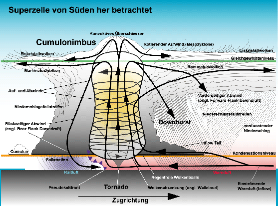
Supercells
Supercells
Supercells are - simply said - an agglomeration of several thunderstorm cells which have aggregated to one big system.
Compared to simple thunderstorm cells, stronger upwinds develop in the center of the agglomeration and stronger
downwinds are observed on the edges. The wind can thereby reach speeds of more than 100 km/h horizontally above the
ground and more than 300 km/h vertically within the clouds.
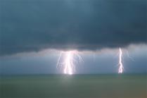
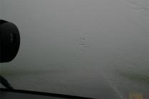
Supercells produce violent precipitation, hail
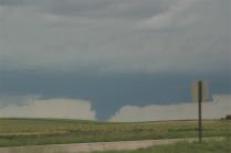
showers and occasionally also tornadoes.
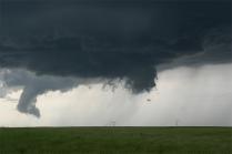
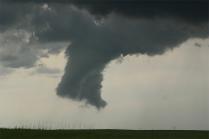
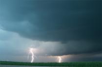
Pictures galerie
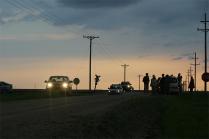
The pictures were taken during a "chase for supercells". They show a part of the size of the storm which these supercells caused.
Description
- Attribute
- Rotation of the upwind area, called mesocyclone
- Up- and downwind areas are spacially separated
- Rotation
- Minimum 30 minutes
- Types
- LP supercells, classic supercells and HP supercells
LP supercell (low precipitation supercell)
The precipitation field is mostly small and is limited to the nucleus. However, very big hail can appear, while tornadoes appear only rarely. This type often appears in the western Great Plains of the USA on the border of humid-warm air from the gulf of Mexico to dry-hot air from the southwest of the USA. In Central Europe, it is rather rare.
Classic supercell
The most frequent and typical form of supercells. The precipitation field is vaster than in the previous case and the nucleus with the strongest precipitation (strong rain and hail) generally wraps in a hook-shape around the meso-cyclone (hook echo). Tornados appear substantially more frequently with this type than with the LP-supercell.
HP supercell (high precipitation supercell)
The most intensive precipitation form of supercells. The precipitation field is very much expanded and spreads strong rain or hail over a rather big area. The nucleus with the most intensive precipitation often shows a nephritic-shaped structure. The precipitation area largely surrounds the meso-cyclone and thereby sometimes covers the view of a possible tornado (bear's cage). These margin-wrapped tornadoes are especially dangerous and are responsible for most deaths in the USA.

