Cloud types
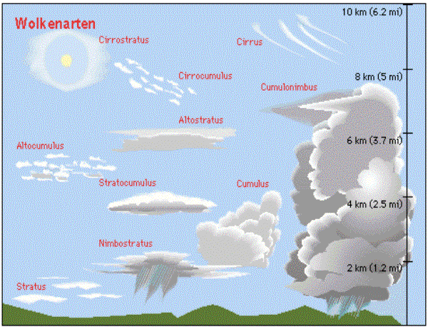
Following the official classification of the World Meteorological Organisation (WMO) there are 10 different cloud types. These can be divided further into subtypes. Here you find a description of the 10 cloud types.
Cirrus

Form
Thin fibres or threads, rarely also bundles; edges usually frayed by the high winds.
Description
Consist of ice crystals.
Interpretation
Fair weather clouds; when compressed it can be a sign of a warm front (precipitation).
Altitude:
8-12 km
Precipitation:
none
meteoblue description:

Cirrocumulus

Form
Heap clouds; occur mostly in more or less expanded fields, which consist of small granular cloud parts, rarely also in small ripped to pieced bundles.
Description
Consist almost exclusively of ice crystals; strongly undercooled water drops will mostly freeze inside the cloud.
Interpretation
Indicate strong vertical movement in the altitude in which they form.
Altitude:
8-12 km
Precipitation:
none
meteoblue description:


Cirrostratus

Form
Layer clouds. Occur either as a fibrous veil in which thin stripe can form, or as a veil-like fog; they can never completely cover the Sun. Under certain conditions, these clouds produce a "halo" around the Sun, caused by the refraction of the sunlight.
Description
Consist primarily of small ice particles.
Interpretation
Indicate the arrival of a warm front (with precipitation) within 1 to 2 days.
Altitude
8-12 km
Precipitation
none
meteoblue description


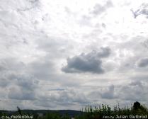
Altocumulus
Form
Heap clouds; appear mostly as a big field which consists of many small single clouds.
Description
Consist almost exclusively of water droplets; only at low temperatures ice-crystals can appear.
Interpretation
Indicate horizontal aerial current and, in addition, vertical currents at some places in the middle cloud layer.
Altitude
2-8 km
Precipitation
none
meteoblue description


Altostratus

Form
Thread medium high layer clouds without contours.
Description
Composed of ice-crystals as well as water droplets.
Interpretation
Indicator for precipitation within the next few hours.
Altitude
2-8 km
Precipitation
rain or snow
meteoblue description


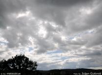
Stratocumulus
Form
Shallow-layer clouds without fibres; appears in spots, fields or layers which aggregate into steadily arranged clouds, bales or rolls.
Description
Consist primarily of water droplets; these are the most frequent clouds; often have grey colouring, because the water droplets absorb a lot of light.
Interpretation
Generally annunciates an instability of the atmosphere. Takes place just before an occlusion between a cold front and a warm front.
Altitude
0,6-2 km
Precipitation
sometimes rain or snow
meteoblue description


Stratus

Form
Low-layer clouds, also described as high fog or above-ground fog; absolutely without structure.
Description
Consist of small water droplets; they can generate halos; often originate with high pressure and low air movement.
Interpretation
Generally indicates a rather quiet weather condition.
Altitude
0-2 km
Precipitation
often sprinkling of rain
meteoblue description

Cumulus

Form
Cumulus are thick heap clouds sharply separated from each other; the edges sometimes look tattered and change constantly.
Description
Consist almost exclusively of water droplets; ice-crystals can only appear at low temperatures; originate with locally restricted upward wind; for gliders and pilots, cumulus are an indicator for upward winds.
Interpretation
Nice weather clouds. If the clouds reach the medium levels of the atmosphere and is turning into a cumulonimbus cloud, light showers may arrive.
Altitude
0,6-2 km
Precipitation
seldom
meteoblue description


Nimbostratus

Form
Very vast, dark grey layer; strong vertical expansion
Description
Consist of water droplets and/or ice-crystals; originate from the upward movement of moist air moving within a warm front.
Interpretation
Long-term rain/snow for several hours or days.
Altitude
0,6-12 km
Precipitation
rain or snow
meteoblue description


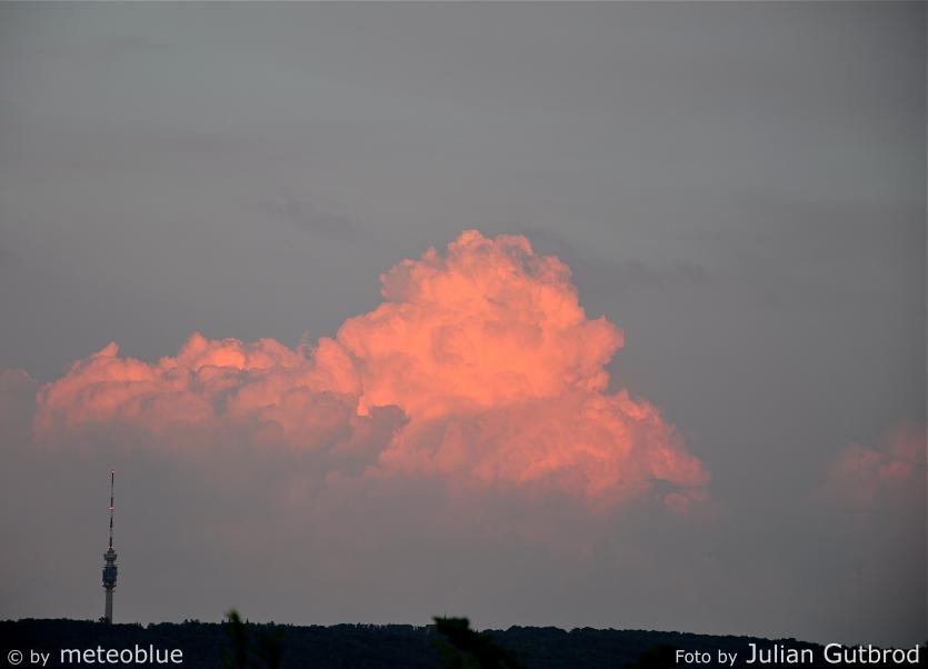
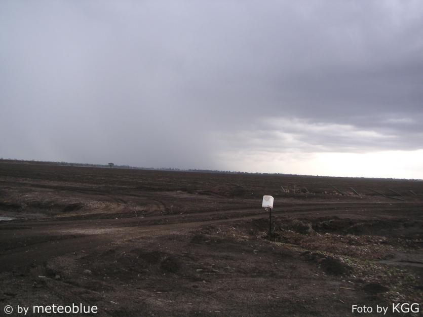
Cumulonimbus
Form
Very big heap clouds with a massive vertical expansion originating from a cumulus cloud.
Description
Consist of water droplets and ice-crystals which however primarily appear in the upper parts. Originate from a big cumulus cloud which, if it contains enough humidity and elevation impulses, expands in altitude. Later, the upper part of the cloud still expands, and give the so-called "anvil" cloud.
Interpretation
Cumulonimbus precipitation falls in the form of rain, hail or snow, thunderstorms are often also present; a full-grown cloud can take up up to 100 million tons of water, hence, violent showers and hail can fall. Moreover, violent hoists which can reach a speed from up to 120 km/h are to be calculated on with cumulonimbus. Within the cloud, there is also strong turbulences, so that they can themselves become dangerous for big airplanes and should therefore be flown around.
Altitude
0,6-12 km
Precipitation
strong precipitation, often with thunderstorm
meteoblue description


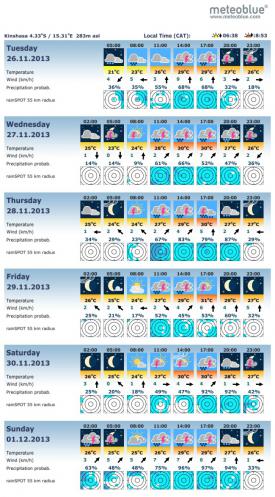
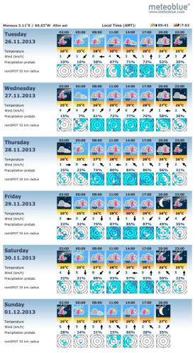
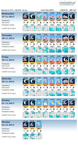
Here you can see the forecast pictocasts for 3 places where you can find frequent thunderstorms - and thus frequent clouds. Compare the meteoblue representation of the cloud types with the forecast. Can you already have a good idea of the weather in Kinshasa, Manaus or Djakarta? Do you also see which clouds mainly cause the precipitation?
