Climate Data & Visuals
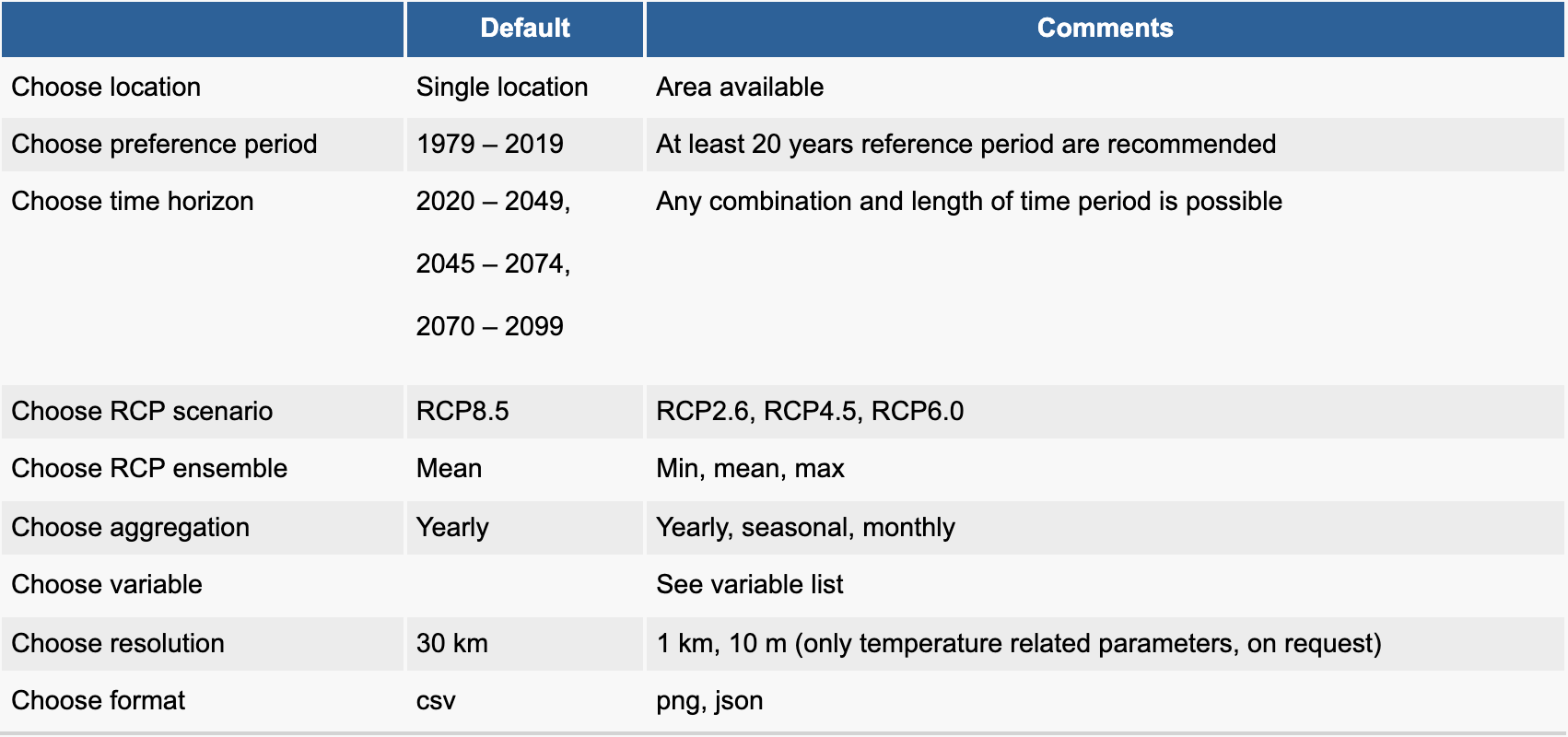
- Any location worldwide at a high spatial resolution
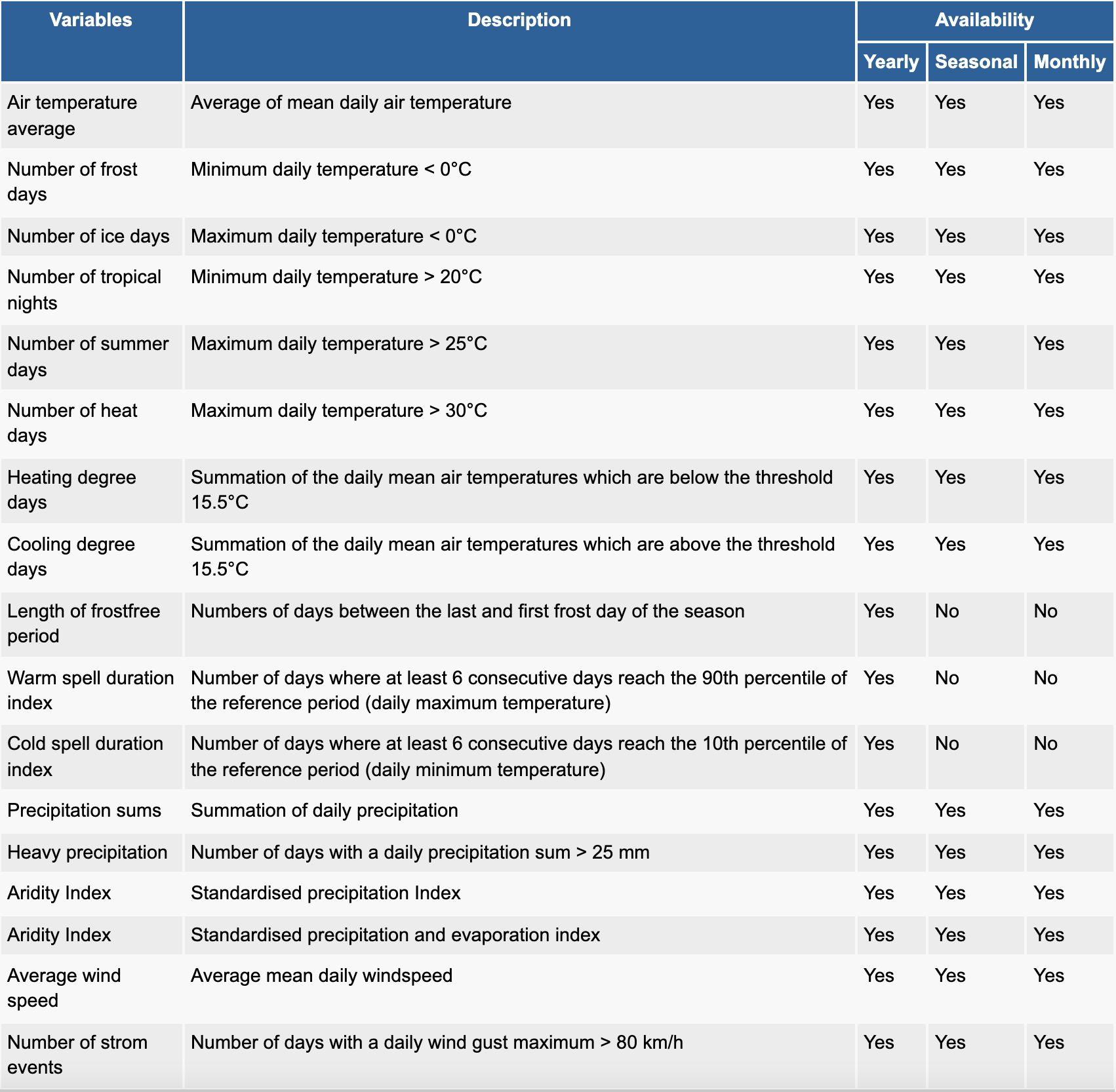
- All common weather variables
- Four future emission scenarios until the end of the century
- Yearly, seasonal and monthly aggregations
- Typical and extreme meteorological years
- Location specific climate risk analysis
- Data formatted as maps, boxplots, and time series. Additionally, all data are provided in the CSV and JSON formats
- 5% of the revenue will be reinvested in climate change mitigation projects
Nowadays, many regions worldwide cope with challenges such as an increasing frequency of extreme air temperatures, storms, and flooding events resulting from heavy precipitation. Due to climate change, such extreme events will occur more often in the future. This trend will increase the risk for economic damage and life threats caused by weather hazards.
The meteoblue climate prediction offers an easy summary of complex climate change simulations for any location on Earth, based on different emission scenarios of the IPCC report.
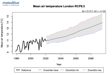
The first diagram shows the yearly mean air temperature [°C] for the time period 1979 until 2100 exemplarily for the city of London (UK). Historical data (black) are based on the reanalysis model ERA5. Projected air temperatures from the current year until the end of the century are shown - exemplarily for the RCP8.5 emission scenario - in black (mean value of the ensemble members), blue (minimum value of the ensemble members) and red (maximum of the ensemble members). Hence, the grey shade represents the uncertainty of the climate models.
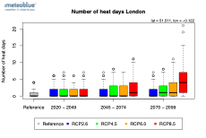
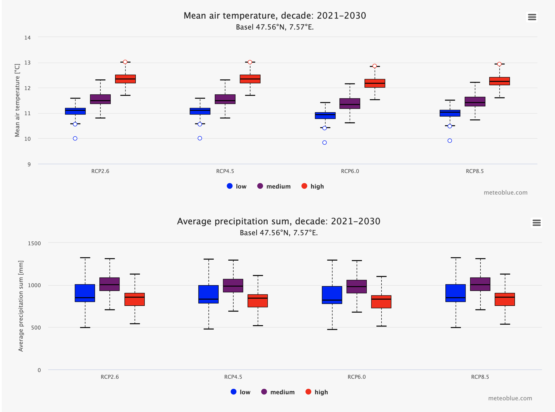
The second diagram shows the yearly aggregated number of heat days for four different time periods (reference, 2020 – 2049, 2045 - 2074, 2070 – 2099) and four different emission scenarios (RCP2.6, RCP4.5, RCP6.0, RCP8.5; in different colours) exemplarily for London (UK). The boxplots in the diagram show the variability within the chosen time period and represent typical and extreme meteorological years.
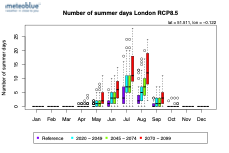
The third diagram shows the monthly aggregated number of summer days for four different time periods (reference, 2020 – 2049, 2045 - 2074, 2070 – 2099; in different colours) exemplarily for London (UK). The boxplots in the diagram show the variability within the chosen time period and represent typical and extreme meteorological months.
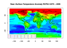
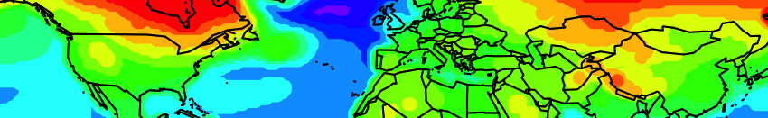
The fourth diagram shows the near-surface air temperature change for the RCP8.5 emission scenario for the time period 2070 – 2099 as a map for the entire world.
The meteoblue climate prediction summarises all these projections for the selected location(s) in simple graphics and tables, readable by any standard software, and offers different configuration options and a large number of variables included in the package.
climate+ Instant access to climate risk assessment data
climate+ provides climate prediction and risk assessment data, ideal for compliance with EU taxonomy. Access temperature and precipitation data for IPCC's four RCP scenarios (2.6, 4.5, 6.0, 8.5) at any global location, with hourly resolution up to the year 2100.

The form was sent successfully.
Thank you for getting in touch, our experts will contact you within a few business days.
