
Climate
- meteoblue next level climate simulations with hourly weather data of more than 80 years
- Analyzing extreme years (P10, P90) of different weather variables
- Finding the ideal site with the combination of weather and environmental data
- Estimating your cooling or heating demand accurately with cold winter or hot summer years
- High speed access to hourly weather time series since 1940 within less than one second
- More than 30 different datasets including measurements, observations, simulations and statistic information
- Knowing the weather risk (frost, drought, storm, flood, etc.) of your site on a weekly basis
- Intuitive climate diagrams show the seasonal conditions of any location worldwide at one glance
To improve business advantage of your site selection – access meteoblue climate data within a matter of seconds
Advanced climate simulations
Images (graphics)
meteoblue offers thousands of images from different categories, that can easily be integrated into your web application. These images can be individually customised as they are available in many languages for any location on Earth.
Climate data & Visuals Understand the arising risks of climate change for any location on Earth
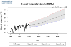
The meteoblue Climate Prediction shows the past and most likely future development of more than 20 variables, including air temperature, precipitation amount and wind speed based on simulation data from the IPCC report. It is available within history+ or as a customised service.
Climate Comparison
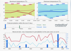
The meteoblue Climate Comparison meteogram visualises the comparison of the weather forecast for a certain area with the measured values in the previous decades. This way you can instantly check into what extent the current weather differs from the long-term climate.
Climate (observed)
Climate (observed) offers a visualisation of monthly values of measured (as opposed to modelled) weather variables. In particular, you can learn about the observed temperature, precipitation and wind speed.
history+ Analyse historical weather data and climate change
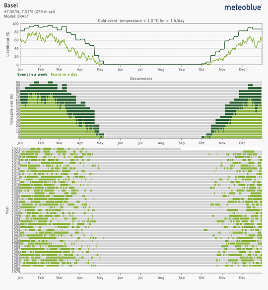
meteoblue offers several risk assessment tools, that bring site assessment to a new level. This is especially useful to assess the frost, heat, flood and drought risk of any location worldwide:
- Warm events (Heat stress)
- Cold events (Frost risk)
- Precipitation (Flood risk)
- Water Capacity (Drought risk)
- Cloud Cover
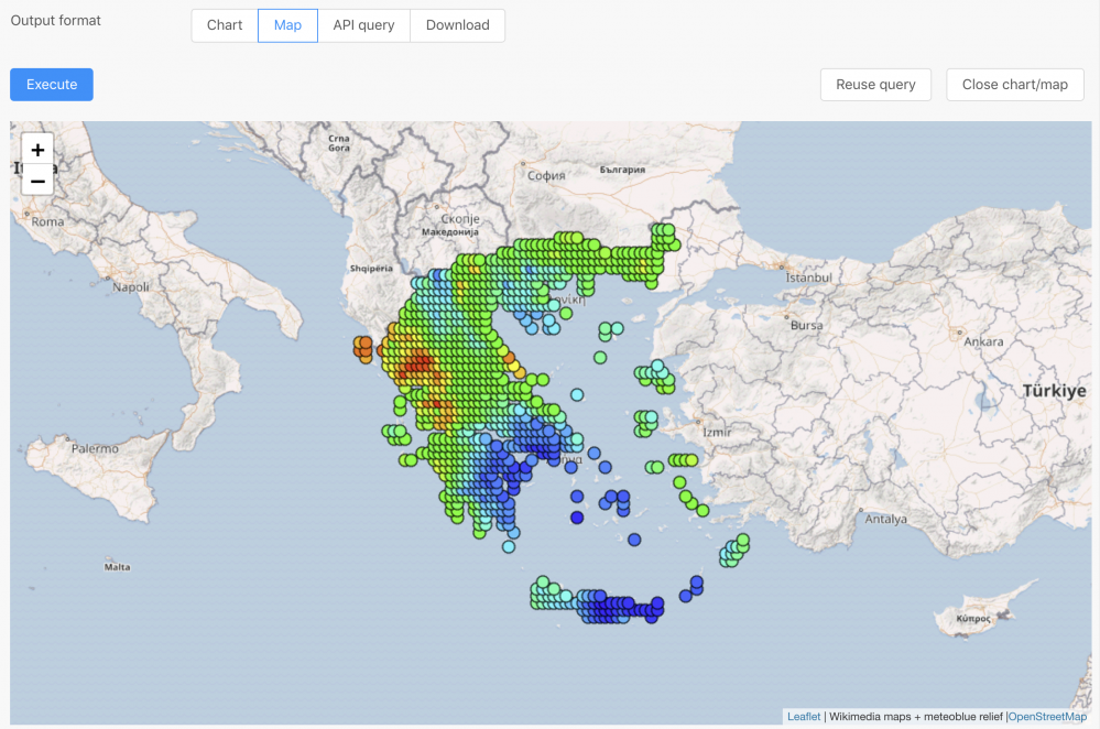
Dataset API The big data API for complex analyses of historical weather data
meteoblue offers advanced site assessment tools, that allow comparisons of all common variables based on more than 30 different data sources with highest accuracy. This helps to find the perfect crop that is suitable for weather and soil conditions of any site worldwide.
History & Climate Data
For climate data we recommend using our high-speed History API, which allows easy retrieval and integration of an extensive selection of weather variables ranging back to 1940, and the Modelclimate data package, which contains climate estimates of the most common variables.
Additional weather variables can be provided on demand.
Prices
For pricing examples, detailed information on the access levels, meteoblue credits, support levels and license conditions please consult our API pricing page.

The form was sent successfully.
Thank you for getting in touch, our experts will contact you within a few business days.
