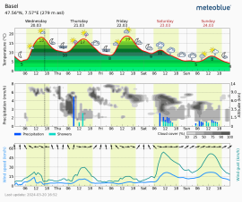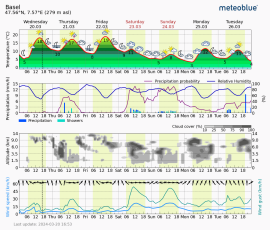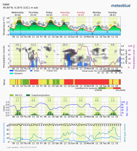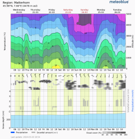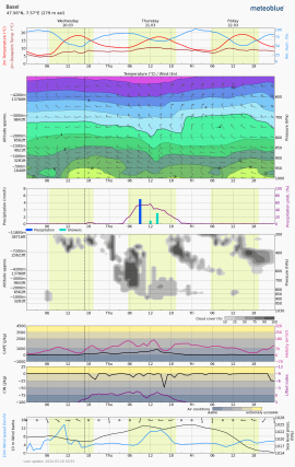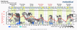
Meteograms
meteograms show local forecast details for any place in the world on diagrams with curves, charts and profiles. Forecasts are calculated for the specific place and altitude shown in the meteogram. In areas with mountains and valleys, the average altitude of the surrounding places is used. When indicated, the update timing for meteograms is printed in the top left hand-side, under the location and position information. If no details are printed, standard update timings are based on the global 00:00 and 12:00 UTC forecast initiation.
point® meteograms are available free of charge on our website, as subscription service (point+) and for commercial customers (meteoblue API ).
Meteograms for the same area can be different, depending on the area and altitude considered for the forecast.
point meteograms adjust the
temperature
to the altitude of the selected place. The
meteogram AIR shows the average temperature for the area.
The extension of the area considered depends on the forecast
model
and may be indicated in the meteogram.
The time axis for point meteograms is shown in local time.
The meteogram AIR is shown in UTC time.
For the conversion of UTC into local time, see our
Hours & dates page.
Here are some samples of different meteograms: