Resolution
meteoblue calculates its own high resolution weather forecast models.
Spatial resolution describes the number of grid cells in a forecast model, as defined by
the distance between two grid cells within the model.
Through high spatial resolution, i.e. small distance
between grid cells, a local forecast can show the effects of local air currents, topography and soil cover. The
forecasts produced thereby show local weather differences in more precise way.
Examples of the capabilities of numerical high resolution forecast are:
- Distinction between valley, slope and summit temperatures in mountain areas.
- Detection of weather barriers (e.g. Alps, Andes, Appalachians) and distinction of resulting thermal, wind and precipitation patterns.
- Display of local thermal phenomena, such as winds (Foehn, Bise, Chinook), thunderstorm activity, etc.
High resolution produces high precision. The weather simulations we produce are highly accurate and often more precise than forecasts made by other technologies or "hand-made". We show the precision we produce on our "Verification" page. The resolution we produce is shown on our page describing our weather model domains. Results of high resolution model are shown on the page documenting "the difference". High dynamical resolution can be seen through our forecasts under the point meteograms, pictocast and maps. Registered users can test high resolution details with the free point+ test subscription.
meteoblue detail weather forecasts are calculated for 1-6 days ahead. For longer forecast period, local detail becomes less important compared to simulating the range of possible weather developments. Therefore, 7-14 day (medium range) forecasts are calculated through lower resolution (generally 50 km) for an entire region. The influence of medium range regional forecasts on local conditions is calculated by adjusting the medium range forecast to the local conditions, mainly for temperature and wind.
Higher resolution historic data are available here: https://www.meteoblue.com/en/weather/forecast/archive/
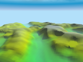
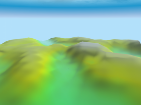
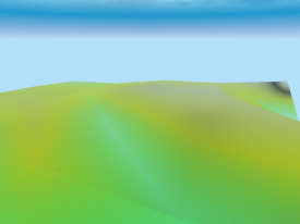
The influence of different resolutions on the aspect of a landscape can be seen on the images below.