
Trade winds
Trade winds
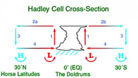
The large temperature and pressure differences around the Earth and particularly between different latitudes create a circulation. The trade winds are part of this circulation and occur in the equatorial area.
Origin of trade winds
Trade winds are caused by the strong warming and evaporation within the atmosphere around the equator.
- Around the equator, the warm air rises rapidly, carrying a lot of moisture. The rising process is stronger than in typical thunderstorms, and further enhanced by the effect of adiabatic cooling: as moisture condensates during the rising of the air, it further warms the rising air, increasing it's upward movement. Thereby, warm air rises 12-15 km high, and is continously followed by more warm air.
- The risen air thereby moves sidewards towards the tropics, and looses heat and further moisture in the process. After a journey of several thousand kilometres, the air has cooled and dried so much, that...
- ... The air starts to sink around the tropics, and finally reaches the ground.
- There, it changes direction and flows back towards the equator, to restart the circulation process.
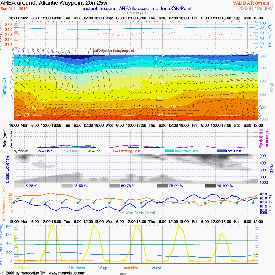
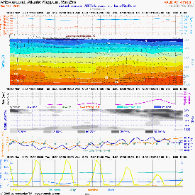
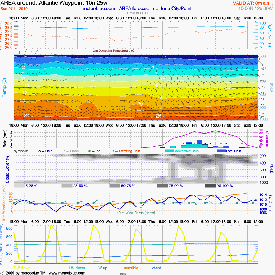
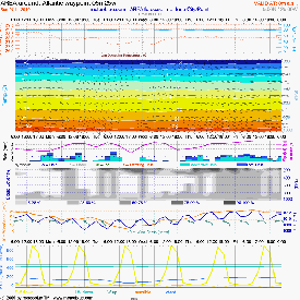
You can also see this circulation on the wind maps.
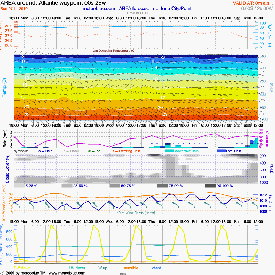
Atlantic Ocean (30°N, 25°W)
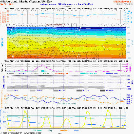
Atlantic Ocean (25°N, 25°W)
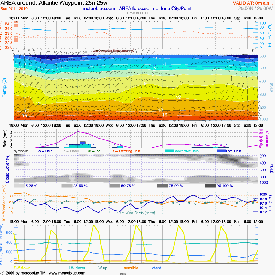
Atlantic Ocean (20°N, 25°W)
Atlantic Ocean (15°N, 25°W)
Atlantic Ocean (10°N, 25°W)
Atlantic Ocean (05°N, 25°W)
Atlantic Ocean (0°N, 25°W) - equator
Circulation
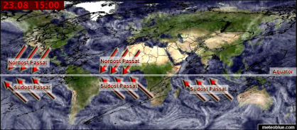
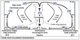
On the world map you well recognise how the trade winds of the tropics blow in the direction of the equator. This effect appears mainly above the oceans, and moves seasonally to the north or south, according to the highest angle of the Sun. Thus, the North and South Trade winds meet approximately 1000-2000 km to the north of the equator during the months July and August; from January to February, they meet about 1000-2000 km to the south of the equator.
The Trade winds are diverted or interrupted by bigger land masses or obstacles. Hence, little or no Trade wind circulation takes place above the continents (Africa, South America), because it is interrupted by the local convection (rise of air) above the land masses. Over the Indonesian islands, the Trade wind circulation is reduced by many small islands, which interrupt these winds. In the northern part of the Indian ocean, the Trade wind circulation can be diverted by the high pressure differences between Africa, the Arabian peninsula and the Indian subcontinent: The strong warming of the Arabian peninsula and the Indian subcontinent during the drying times leads to a constant flow of colder air from the ocean towards the continent, and this creates a northern air flow from the northern Indian ocean towards the Indian continent for several months per year.
Because of these temperature stratifications of the very warm air from the equator region on the relatively less warm air of the higher latitudes, the steady "trade inversion" is formed. This trade inversion prevents the vertical air exchange between the high streaming towards the polar region and the near-ground streaming towards the equator. Therefore this circulation is very stable.
Above the continents (Africa, South America) there is nearly no trade circulation because it is interrupted or redirected because of the local convections (the airdraft) over the landmasses.
Influence on climate
Trade winds have a big influence on the climate to the north and to the south of the equator. The main effects are:
- Continuous removal of humidity from the areas around the tropics = desertification.
- Continuous supply of humidity to the equator region = rain forest.
You can see these effects on the World weather maps.
Influence on seafaring
- Trade winds are so strong that the sailing ships of the European discoverers could only sail with, but not against them.
- Trade winds blow without interruption. Profiting from or correcting course during wind breaks is not possible.
Seaways of the european discoverers
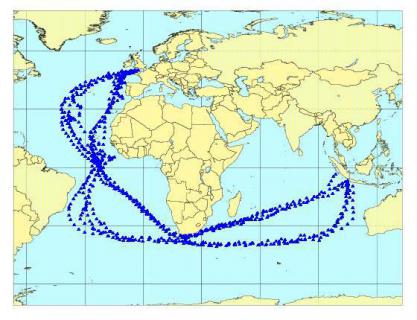
The European discoverers of the 15th and 16th century crosses the oceans
with caravels (sailing ships which were approx. 25 metres long and had 3 masts). These ships were the first which
were able to sail against the wind, by "crossing" in a 30 to 45° angle against the prevailing winds.
To sail
against the wind was still very time consuming, and progress was slow. Therefore, it was suitable only where no
other ways were available to reach the destination. Therefore, the seafarers always preferred the routes on which
they could sail with the prevailing winds, even if these routes were longer than others.
You can see this,
comparing the main sail routes to the trade winds. An example of main sail routes used by the discoverers can be
seen on the map beside ("Seaways"). Try to find out which routes were used going from Europe to India, and which
routes were used for returning from India to Europe. This is clearly visible with the help of the help of the
Worldwinds (see the film above).

