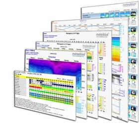
рoint+
point+ provides high detail precision forecast diagrams for any location worldwide. point+ offers services for ballooning,
climbing, sailing, surfing, event organisation, tourism, construction, road maintenance, building management,
insurances and others. Through a point+ subscription on www.meteoblue.com, you have access to printable meteograms, to Air
diagrams such as Stueve and Sounding, to Astronomy Seeing predictions and to the whole meteoblue
weather archive. With a point+ subscription, no advertisement will be displayed on the meteoblue website. The
subscription will end automatically after the subscription period.
References
point+ subscription
You can subscribe to point+ for 1 month, 3 months, 6 months or
12 months.
If you are registered, you can test the point+ subscription
once free of charge for 14 days.
How to get point+
- Register for free on the meteoblue website
- Go to the point+ purchase page
- Select desired point+ subscription
- Select payment method
- point+ is now ready for use
- sometimes, it may be necessary to log out and log in again to activate point+
Using point+
You can view, print and store point+ images - and send them to others, or
archive them so you can always go back and check how good the forecast was. To print an image, save the image first:
click on the download button below the image, or (right-) click on the diagram, choose a file name and directory and
save it. The standard diagram format is .png. Then open the image with an image program and print.
point+ also
works on most mobile phones with internet access. If the
www.meteoblue.com website displays well on your mobile device, point+ will also work well.
point+ updates
point+ diagrams are updated at least 2 times a day. Update times are displayed in the diagram headers.
The period since the last update of the diagram is indicated above the diagram- in hours, minutes and seconds. For
images which are updated more frequently, you may be advised to refresh the diagram, to see the most up-to-date
image. For more information on updates, see the following link: Updating.
point+ features
- 2h rainNOW
- rainNOW is a nowcasting service which shows precipitation in intervals of 15 minutes for the next 2 and
the past 4 hours. rainNOW is updated every 15 minutes with the latest precipitation forecasts, 24 hours
a day. more
- Meteogram
- The meteogram shows the weather forecast for the next 6 days with symbols, temperature curve,
precipitation amount, type and probability, cloud cover as well as wind speed, direection and gusts. more
- Meteogram Snow
- The Meteogram Snow 1-6 days shows the local development of temperature in various altitudes, the
precipitation, snow melt and snow height at ground level in hourly steps for the following days. more
- 14 Days (detail)
- The Meteogram 6-14 days summarises hourly forecasts starting from forecast day 6 until day 14. This
meteogram gives a good overview of the probability of the expected weather condition. more
- Meteogram Agro
- The meteoblue meteogram Agro shows the development of the weather with diagrams of air temperature, wind
velocity, precipitation, clouds, spraying windows, evapotranspiration and humidity. more
- Meteogram Air (6 days)
- The Meteogram Air shows the weather development in the atmosphere for temperature, relative humidity,
dew point temperature, wind speed and direction, precipitation, clouds, sea level pressure and radiation.
more
- Astronomical Seeing
- This diagram is a service for astronomers, meteorologists and other users who depend on a good forecast
of sky visibility and atmospheric conditions during the coming days. more
- Soundings
- meteoblue Soundings show the weather development in the atmosphere, from ground to stratosphere level
(pressure levels 1013 to 100 hPa) simulating the measurements of sounding balloons. more
- Stueve
- The Stueve Diagram shows air conditions within one diagram. It shows temperature, air pressure,
different lapse rates, saturation mixing ratio, dew point, relative humidity, cloud cover, wind speed
and direction and a velocity diagram. more
- Cross-Section
- meteoblue air Cross-Sections show a vertical cut through the atmosphere. The standard Cross-Sections
have 2 directions: north-south and west-east. more
- Trajectories
- meteoblue air Trajectories show the air movement from the selected place throughout the following hours,
for the selected altitude level (between surface and 150 hPa, i.e. approximately 10 km). The trajectory
is calculated by simulating the air movement (wind) from the selected location. more
- Weather archive
- The weather archive offers access to past weather simulations for every place in the world. You can find
weather information of yesterday or the weather history since 1985. more