- meteoblue nowcasting uses instant weather information from all available sources to adapt the forecast of the current day
- Automated implementation of nowcasting on all forecasts retrieved through the meteoblue weather API
- Real time correction of meteoblue wind and temperature forecast with measurements from more than 100'000 stations
- Correction of intraday radiation and cloud forecast based on METEOSAT images every 15 minutes
- Hourly access to aviation weather (flight conditions, pressure, wind, cloud height, visibility) of all airports
- Assessing the risk of thunderstorms and precipitation every 5 minutes based on high resolution radar data
- Easy understanding of complex information with sophisticated visualisations like rainSPOT or precipitation radar
- Checking the actual weather conditions by watching live composites of worldwide satellite images
meteoblue allows you to be always up to date: Take the right business decision accessing all available weather data on a minutely basis.
Nowcasting applications
Images (graphics)
meteoblue offers thousands of images from different categories, that can easily be integrated into your software. These images can be individually customised as they are available in many languages for any location on Earth.
Precipitation radar
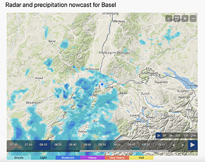
meteoblue offers animated maps for precipitation radar as simple plugin for your website or app. Dynamic maps can be easily integrated in a matter of minutes. Radar images are always centered on a certain location to provide an optimal user experience. The user is able to move and zoom the viewport and control the animation. Radar maps are available in a time resolution of 15 minutes with minute-to-minute animation for most countries in Europe, North America, South America and some more. The precipitation radar observation consists of animated images of the last 2 hours. In most regions meteoblue offers an 2 hour projection into the future as well.
rainSPOT
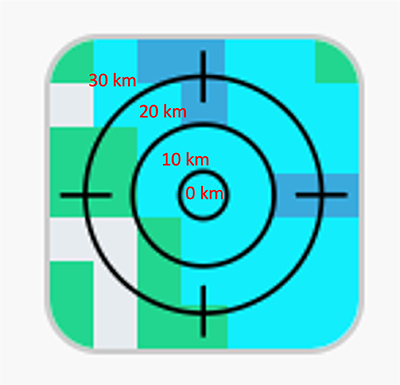
The rainSPOT shows precipitation in the surrounding of the selected location for the time interval (hours) preceding the indicated time. Thus it summarises the current or future precipitation conditions at a glance. It is available as raw data feed or image through the meteoblue weather API for any location worldwide.
Satellite images
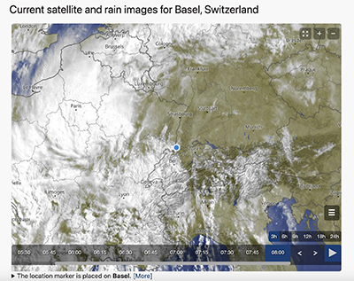
meteoblue offers animated maps for satellite data as simple plugin for your website or app. Dynamic maps can be easily integrated via iframe in a matter of minutes. Satellite images are always centered on a certain location to provide an optimal user experience. The user is able to move and zoom the viewport and control the animation. The satellite maps are available any region worldwide.
Weather maps
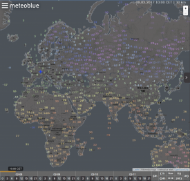
meteoblue offers various layers for our weather maps, that can easily be integrated into any web application. All maps are available through the meteoblue API and on the meteoblue website. The meteoblue API delivers the maps as graphics in PNG format that have to be implemented on a map (e.g. GoogleMaps). The following layers include observations of the last hour:
Forecast & History APIs
Generally hourly nowcasting correction is applied on all our data packages for temperature, wind, precipitation, clouds and radiation, where observational data is available. Actual data can be accessed with the following data package:
- current - contains information about the current weather
Prices
If you need more information and prices for business purpose, please send us a request to [email protected] (or click on the "contact us" button below) with the following details:
- Desired data package/image:
- Approximate number of daily requests (e.g. number of locations x number of daily updates):
- If you want to test the meteoblue API for free for 14 days, please also provide the organizational details:
- Company name:
- Address (street, postal code, city, country, website):


