The Trans-African Hydro-Meteorological Observatory (TAHMO) aims to develop a vast network of weather stations across Africa. Current and historic weather data is important for agricultural, climate monitoring, and many hydro-meteorological applications.
The TAHMO initiative is committed to serving the public by advancing the free and open exchange of hydro-meteorological data collected with its monitoring stations. By allowing the free download of all raw TAHMO data for scientific research and governmental applications, TAHMO supports World Meteorological Organization (WMO) Resolution 40 and Resolution 25. Commercial applications of TAHMO data are considered on a case-by-case basis.
meteoblue began to supply weather forecasts in 2021, due to the unique ability to produce high accuracy forecasts also in tropical climates.
Customer success story:
How to build a network of
weather stations in Africa and deliver the data
to the local farmers

Let us start with several basic facts and figures:
- Africa is the home of over 1.2 billion people.
- Presently, hundreds of millions of them have limited access to clean water.
- What is more: due to factors such as rapid population expansion, socio-economical vulnerability, lacking infrastructure, and – last but not least – the ongoing global climate change, this number is projected to increase in the future.
- Further aggravating this dire situation is the current lack of a reliable and dense network of weather stations, because without monitoring the weather it is virtually impossible to anticipate the future water levels.
- Africa is also the continent where 60% of the world's undeveloped arable land lies, and where 70% of produced food comes from small farmers.
If you connect these dots, you get a dismal picture:
Imagine you are a farmer in Africa, trying to grow crops for your family as well as for sale, but your water supply is already limited, becoming more and more unpredictable, your parents' weather sayings are no longer useful to you due to the changing climate, and you have no access to trustworthy scientific weather data.
How do you know the right amount of crops you can plant and water throughout their lifecycle?
If you plant too many, you will not have enough water and your crop either dies or it does not grow fully, and all the seeds and fertiliser will be squandered. Conversely, if you plant too few, you will not have enough for your family and/or for sale.
What do you do?
This is where TAHMO comes in.
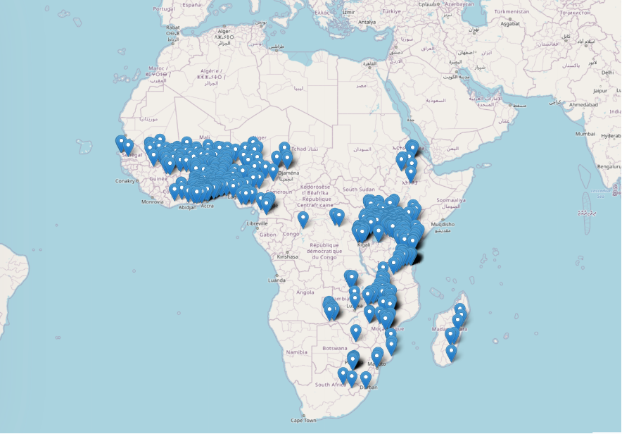
TAHMO (Trans-African Hydro-Meteorological Observatory) is a non-profit organisation based in the Kenya (and proudly supported by meteoblue). It aims to develop a dense network of hydro-meteorological monitoring stations in sub-Saharan Africa – one every 30 km – and thereby fill the colossal gap in the vital weather data. Does the idea sound overly ambitious? Let us take a look at how TAHMO is planning to deliver.
Current weather infrastructure in Africa
As outlined above, the present state of hydrometeorological monitoring and data distribution in Africa could be labelled as "developing". African observation networks are very limited, and national governments and regional planners do not have the data to make proper decisions regarding investments in water resources infrastructure. The national hydrometeorological institutions are often severely underfinanced. Exacerbating this is also the fact that there is frequently insufficient communication within countries and regions, creating data gaps at multiple levels.
Moreover, the limited number of weather stations in Africa is spread out over enormous distances; most are found only at the opposite ends of the continent – in northern Africa and southern Africa. Regrettably, this leaves further huge data gaps in the central part of the continent.
Finally, another key challenge for weather and climate monitoring in Africa is the availability of historical data. In the past, most of the collected weather data was only recorded on paper, and not catalogued electronically, which effectively renders it useless.
TAHMO's solution
In order to succeed in such a gargantuan task, TAHMO had to come up with innovative solutions on more than one level. Specifically, it was the design of the weather stations, the locations where they are placed, the distribution and maintenance of the stations, as well as the dissemination of the measured weather data.
Stations
One thing was clear from the beginning: TAHMO had to make sure the weather stations used in the project are exceptionally affordable, reliable and durable. Because no such stations were available on the market at the time, they had to be tailor-made for this project. Two sensor design competitions were organised (in 2013 and 2014) in parallel to see if additional sensors could be incorporated, which resulted, for example, to the inclusion of a lightning sensor. Many of the engineers and scientists who were involved in the workshops are still part of the TAHMO network.
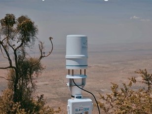
The winner, the MEM station by the Meter Group, was developed in close cooperation with TAHMO, with special attention to African conditions. It has no moving parts, which greatly reduces the maintenance burden, and thus the stations have become optimal in terms of high-quality measurements and cost-efficiency. Currently, there are there are 600+ stations deployed in 20 African countries.

Placement
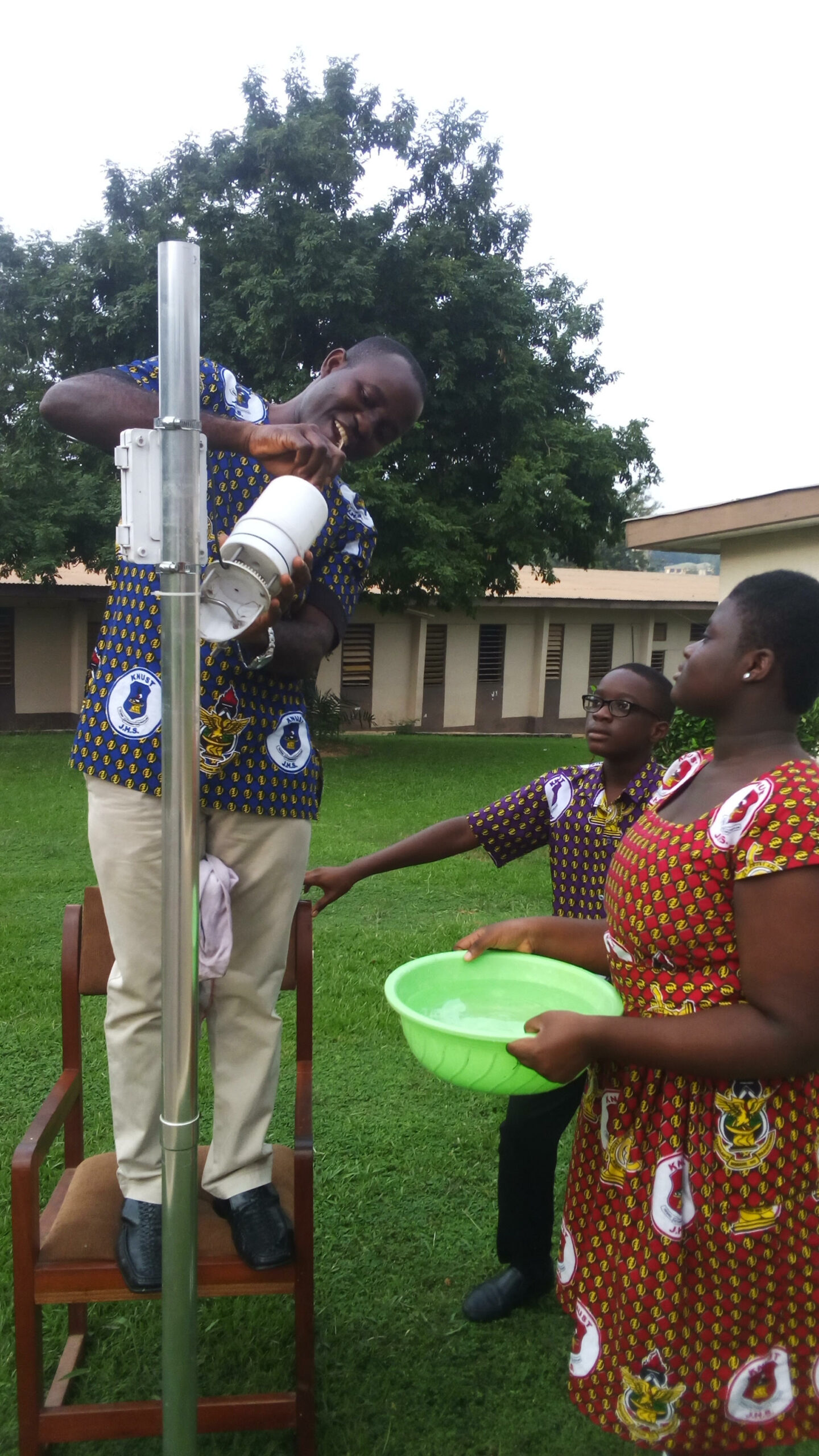
Another innovative solution that TAHMO came up with was the station placement. For this reason, TAHMO organised the School2School program (S2S), inviting schools across Africa to participate. The idea is simple: various types of schools (from primary level to universities) are invited to apply for membership and become a "sister school", which enables them to install the MEM weather station at a safe outdoor location in the school's vicinity. The school nominates 2 dedicated staff members who take care of the station's maintenance, collect the data, and ensure their transfer.
But it does not stop here – TAHMO also designed a weather-oriented educational program, the purpose of which is to Integrate the weather station and collected data into the schools' curricula. The individual schools also interact in a classroom exchange with other sister schools, and provide feedback on educational activities and data accessibility. Teachers must attend a professional development workshop about TAHMO education modules and applying activities in the classroom. Through these measures, TAHMO hopes to add richness to the curricula, and help foster a new generation of scientists.
Data distribution and usage
The collected weather data is displayed in an interactive interface on TAHMO's website and on their specialised portal. Via these channels it is made accessible to anyone from the general public. TAHMO also offers the raw data to multiple subjects: national hydrometeorological institutions, researchers and scientific teams can access the data freely.
A fee is incurred for commercial use of the data, including the development of new services. The fees depend on geographical coverage and level of exclusiveness of use within a sector while respecting the national policy on data use. The revenue is used to maintain and grow the observation network.
Outlook
In the future, TAHMO intends to broaden the station network, expanding into further African countries and reaching the goal of 20'000 operational weather stations. Furthermore, lLocal weather data will be combined with weather and climate models (i.e., computer simulations of future states of the weather and climate), and satellite observations in order to obtain insight into the distribution of water and energy stocks and fluxes.
"We are solving the problem of getting climate data into African hands", says John Selker, TAHMO's co-director. "We're building the bridge between the climate and productivity."


