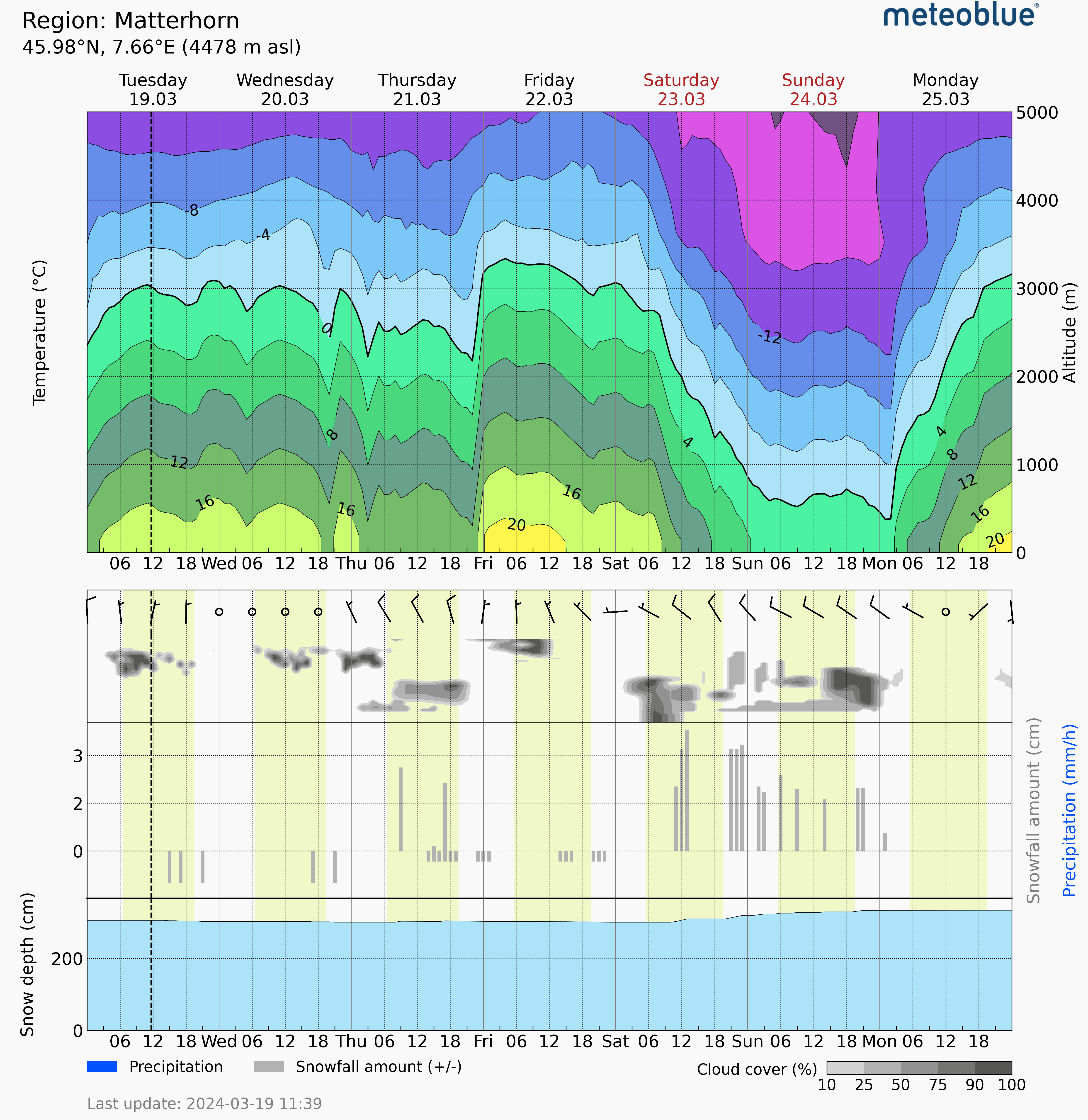
You can find Meteogram Snow on the meteoblue website.
Meteogram Snow is a diagram that visualises snow conditions in a specific area. Offering a detailed 7-day forecast, it displays various aspects of snow, including hourly temperature at various altitudes (highlighting the freezing level with the bold black curve), the amount and type of precipitation (blue for rain and grey for snow) for each hour, the amount of snow melting over time, and the average snow depth on the ground for the surrounding area. This information enables you to plan activities and anticipate snow accumulation or melt throughout the season.
Meteogram Snow represents an area (grid cell), rather than a specific location. The displayed elevation reflects the average elevation of this grid cell, which may differ slightly from a specific location. Additionally, the time axis uses local time, valid when the forecast is generated.
While Meteogram Snow provides a valuable area overview, the actual snow conditions can vary significantly within short distances. This forecast should not replace on-site measurements, or be used for critical risk assessment.
Meteogram Snow is well-suited for short-term activity planning in snowy areas, monitoring regional snow conditions, and gaining a general understanding of seasonal snow accumulation and snow melt.
This meteogram is available with a suscription to point+ or through meteoblue API.


